By Lisa Haven
Have the fires in California been planned all along? Is there an agenda by the United Nations in conjunction with the Democrats for a land grab and to push the Agenda 21 and fake Climate Change narrative?
You might be convinced after this report in which I prove using a map from 1992 that that is EXACTLY what is happening…
GET INVOLVED IN TRADE GENIUS ACADEMY:
((SPECIALS LAST THROUGH BLACK FRIDAY))
For More Information See:
Patent- https://patents.google.com/patent/US7629918B2/en
Patent- https://patents.google.com/patent/US5486833A/en
1992 UN Biodiversity Document https://www.cbd.int/doc/legal/cbd-en.pdf
Biodiversity Map- https://www.metabunk.org/explained-map-of-simulated-reserve-and-corridor-system-to-protect-biodiversity-anti-gov-org.t6855/
California Hazard Map- https://www.sfchronicle.com/business/article/California-fire-threat-map-not-quite-done-but-12491529.php


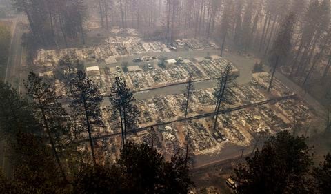
I am short of time today but just wanted to make a short comment. In my opinion, from what I have read and seen, yes there is more to these fires than meets the eye and more than what the MSM is telling us. It is well known that the UN with their UN Agenda 21 has plans to control the entire earth. This is not a conspiracy theory but a conspiracy fact. That is what UN Agenda 21 is all about, earth wide dictatorship under the control of the UN. And who controls the UN? It is the globalist elite, Rothschilds (who control PG&E), Rockefeller, etc. along with their black Nobility friends (royals). The intent is to have this in full operation by the year 2030 (thus Agenda 2030) which is only 11 short years away. Would they stoop so low as to cause these fires? If it would advance their Agenda , yes they would. Evil did not die with the NAZI’s but it remains in effect with the globalist elite who plan to rule the world just as surely as Hitler did. With these people the end justifies the means. Part of Agenda 21 is to make certain areas completely off limits to human habitation (the red areas on the Agenda 21 map). And as brought out in your video these are the very areas that are being burned in California. Under Agenda 21 those areas must be free of human habitation. If you can’t talk people into leaving their homes and evacuating those areas then burning them out is another means to accomplish the goal of removing humans from those lands to be repurposed by UN Agenda 21. Would they do something so dastardly? Yes I think they would. They have the ways and means to do it and their agenda of getting people out of those land areas is running short now. Remember it is now Agenda 2030. Directed Energy Weapons can invisibly cause super heated fires to burn almost anything, even melting cars and steel at times, which we have seen in these fires. Many of the fires have burned neighborhoods and autos while leaving a belt of untouched green trees around the area. How does that happen? DIRECTED energy. Lazers with temps into the thousands of degrees. It is a snap with the technology they now have. Well that is all I have time for, my mind is racing with thoughts but no more time today. In a nutshell, yes the UN is possibly behind this. Yes they have motive to do it. No it is not coincidence that the areas being burned are the same as the UN Agenda 21 map red areas. I believe we are under attack and the source of that attack is the globalist elite and their UN. By the way, CalExit is being backed by the UN and if California leaves the U.S. under CalExit it will fall under the control of the UN. Also the border invasion is UN Backed. Go figure.
Mike Morales on his Youtube site https://www.youtube.com/results?search_query=Mike+morales has done an excellent job of documenting the California “Camp Fire” fire. It began as a 5000 foot high explosion with other explosions accompanying it. Also aircraft, probably choppers of some sort, were in the area near where and when the fire started. The blast ring was seen over the Pacific ocean. Aircraft are spraying a huge amount of incendiaries, like Nano Aluminum over California and other states as well, to dry things out. The aircraft trails are clearly seen in weather maps. Also other videos show houses that have burned while the bushes and trees surrounding them are intact.